Valley Springs Community Plan Information Page
Valley Springs Community Plan: Background & Commentary
1. Community Consensus Plan Process
New! Final Version, Draft of the Valley Springs 'Community Consensus' Plan
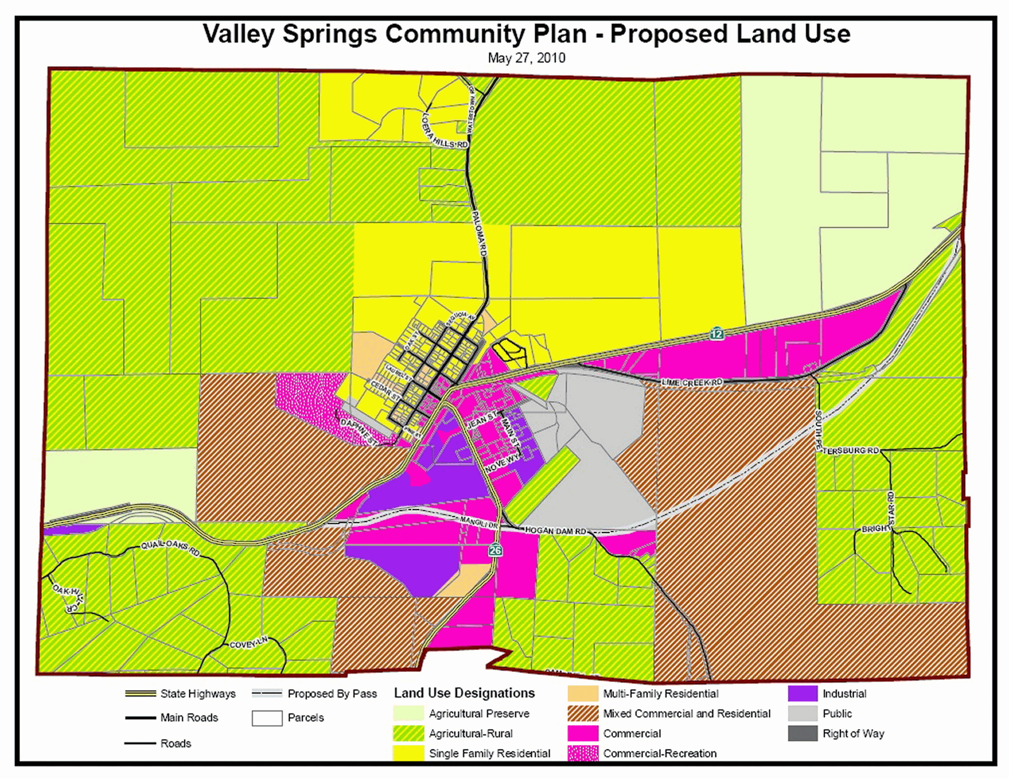
This is the map (directly below) generated by the community-based planning process paid for by the Cal-Trans planning grant, and administered by the Calaveras Council of Governments. Project partners include Calaveras County, the Local Government Commission, and MyValleySprings.com. It is a large rendereing so as to see the details. Please use the scroll bars to navigate.
It was accepted by the Supervisors as an Alternative. Please click here for more information on this Plan.
Please click here for results of a Community Survey taken as part of the citizen participation process.
The image is set at 200 dpi, and can be printed on an 11x17 page.
To view / print the Tofanelli Map and Draft Plan, please scroll down or click here
--------------------------------------------------------------------------------------------
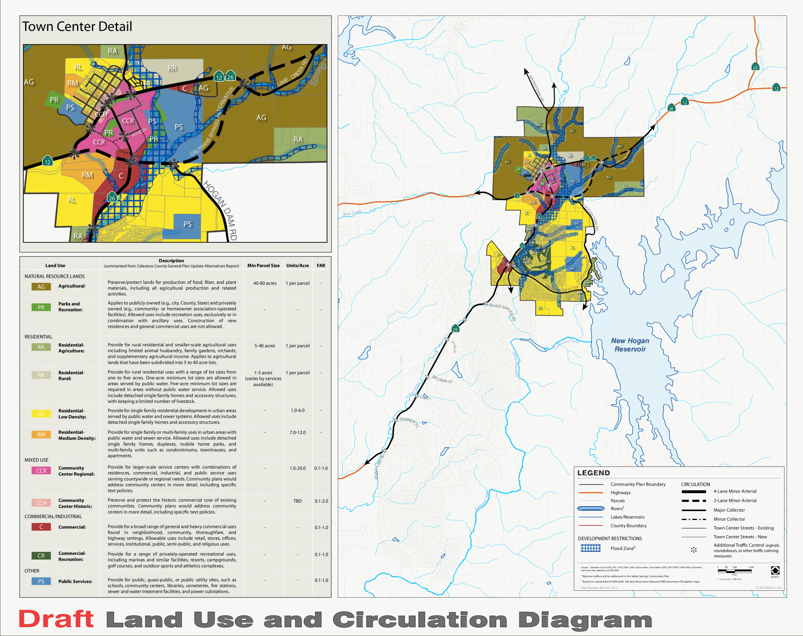
2. Tofanelli Plan
This is the map and draft Community Plan generated by Supervisor Tofanelli's select group, some from well
outside Valley Springs, in an initially closed process. It is a large rendereing so as to see the details.
Please use the scroll bars to navigate.
Please click here for final version of the Tofanelli Plan. (note: large filesize ~ 34mb)
Click here for Public Comments on the Tofanelli Plan (note: file size ~ 11 mb)
The Supervisors have voted to accept the Tofanelli map as the Preferred Alternative.
The image is set at 200 dpi, and can be squeezed onto an 8.5 x 11 page.